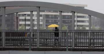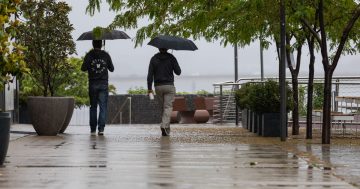
After a dry start to this year’s Easter long weekend, rain will take over and see you back to work. Photo: Michelle Kroll.
The Easter long weekend will dawn bright and sunny – but it won’t finish that way.
Bureau of Meteorology (BoM) meteorologist Tristan Sumarna told Region that a large cold front is set to sweep over much of southern Australia in the coming days.
“That is likely to bring an increased chance of showers and is likely to also bring an isolated chance of a thunderstorm,” he said.
“As we head into Easter Monday, showers and rainfall will be at their peak. By Easter Tuesday, all the showers are expected to start moving offshore and [conditions will be] easing across the southeast.”
The system is expected to span much of southeast Australia, including Canberra, as well as the Riverina and the NSW Far South Coast.
In Canberra, the Bureau is forecasting mid-20s for the long weekend, with a high of 27 degrees on Saturday (19 April).
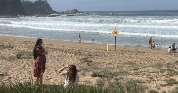
But if you’re the type of Canberran to evacuate to the South Coast when a long weekend arrives, remember to pack sunscreen – and also keep one eye on the surf.
Batemans Bay will reach a high of 27 and 26 degrees (on Saturday and Sunday, respectively), while both Bega and Moruya will record temperatures in the mid-20s.
The forecast is being driven by cold air in the upper atmosphere, which means warmer air closer to the ground will rise – and bring an increased chance of rain.
“We are expecting some of those [rainfall] totals to be higher along the coast, particularly because we’ve got those onshore winds.
“They’re likely to back up against the Southern Ranges, causing an increased amount of rainfall … as opposed to more inland in the Canberra region.”
However, it is too early to predict how much the rain gauges will record.
“It’s always handy to keep up to date with the latest warnings and forecasts, as there is a little bit of uncertainty within the weather models as to how much rainfall there is and exactly where the rainfall will be,” he said.
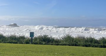
On Friday and Saturday (18 April and 19 April), a system will be stirring up the seas and bringing hazardous surf conditions along the coast.
“There is a fairly large and deep low-pressure system off the western coast of New Zealand that’s driving some of those hazardous swells,” he said.
“While it may be quite sunny and a good day to go out, the surf on the beach will be particularly strong and could be potentially hazardous.”
Mr Sumarna encouraged people to be careful in the water if they head to the beach to cool off.
“Currently, we’re forecasting for sea surface temperatures along the South Coast [to be] around 20 to 21 degrees or so,” he said.
“That is about average for the South Coast. This low-pressure system isn’t actually making the waters warmer. It’s just bringing some of its bigger potential for larger waves to approach the coast.”
After the large cold front passes over southern Australia, Mr Sumarna said the Bureau’s forecast is predicting “more settled conditions” from mid-week onwards.
“[The conditions over the long weekend] will give very nice autumn rainfall for the region,” he said.
“This will be very likely normal for autumn, and it will start putting an end to the heat that we’ve been experiencing over the past couple of weeks or so.”