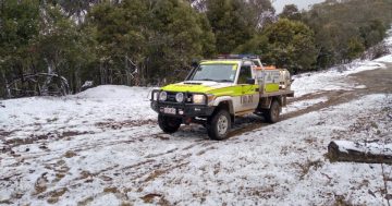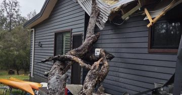
Strong winds will sweep across parts of south-east NSW and Canberra over the coming days. Photo: NSW SES.
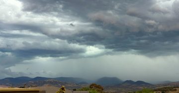
A series of strong cold fronts are sweeping across south-east NSW and Canberra today (24 June) bringing with them damaging winds, lowered snow levels and chilly conditions.
The first system moved through overnight with widespread rain forecast for the rest of today and into tomorrow (25 June).
Bureau of Meteorology senior meteorologist Miriam Bradbury said the fronts meant snow’s possible for lower elevations.
“Cold air will sweep across the south-east from later tonight, bringing small hail and snow down to around 700 or 800 metres,” she said.
“From later today those cold, snowy conditions, combining with strong winds, bring the risk of blizzard conditions about … southeast NSW.”
Vigorous winds will accompany the cold fronts and a severe weather warning has already been issued for damaging northwesterly winds.
“Damaging winds are most likely with showers and thunderstorms, but anywhere we do see them, there is the risk of trees and tree limbs being brought down, leading to dangerous driving conditions, possible damage to property and cars, and even possible power outages,” Ms Bradbury said.
“There may be periods of lulls in the winds today … but we’re not expecting this blustery period to properly ease until Wednesday, going into Thursday.”
The wintry conditions are expected to really take hold on Wednesday.
“The snow level will be very low on Wednesday morning, to around 700 to 800 metres … but this will gradually lift through the day,” Ms Bradbury said.
“Vigorous westerly winds will continue to barrel across the Great Dividing Range, producing a very windy Wednesday for much of the east coast of NSW, including … the Illawarra and the South Coast.
“Warnings are likely to continue over these areas into Thursday.”
Canberra has a forecast maximum temperature of 8 degrees on Wednesday and 11 degrees for Thursday, but the wind chill will make it feel much colder.
Goulburn will shiver through a windy top of 7 degrees on Wednesday and 9 degrees on Thursday.
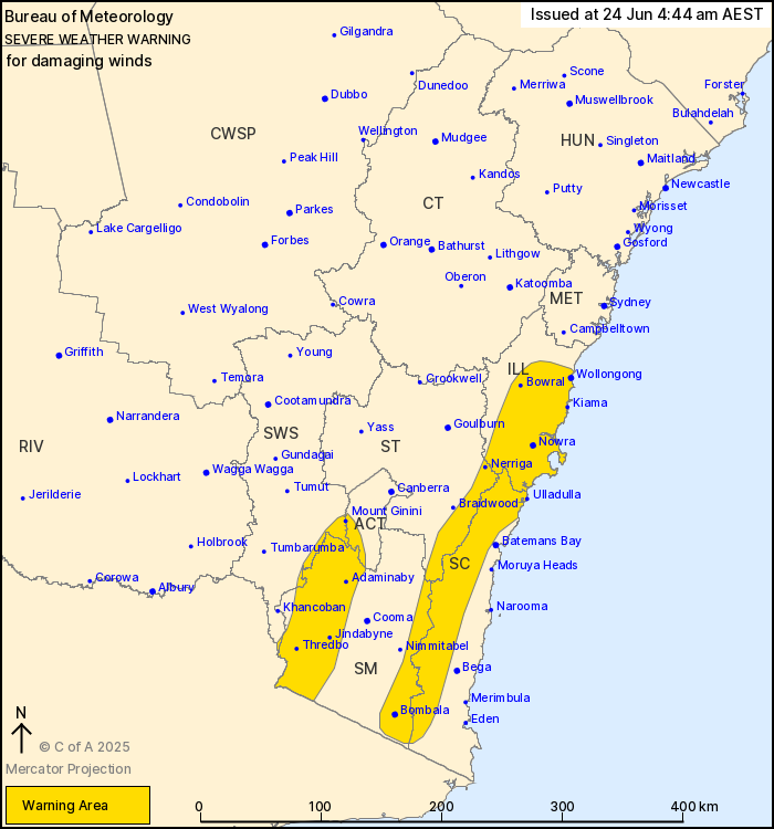
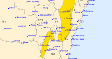
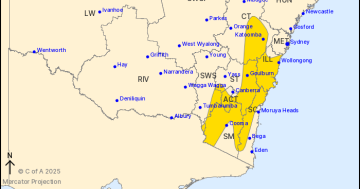
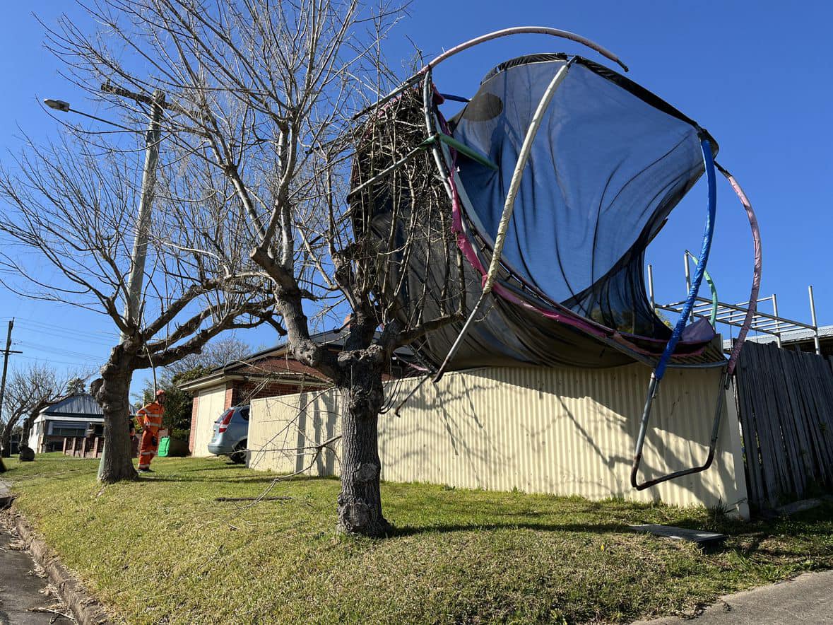
A damaging winds warning has been issued for parts of the Illawarra, South Coast, Southern Tablelands, Snowy Mountains, ACT and South West Slopes. Photo: BoM.
On the coast, showers will keep things warmer.
Wollongong has a forecast maximum of 16 degrees for both Wednesday and Thursday.
Further south, Bega, Merimbula and Batemans Bay all have forecast highs in the mid-teens.
Damaging wind warnings are expected to be issued throughout today and tomorrow.
The State Emergency Service advises people should:
- Move vehicles under cover or away from trees
- Secure or put away loose items around your house, yard and balcony
- Keep at least 8 metres away from fallen power lines or objects that may be energised, such as fences
- Trees that have been damaged by fire are likely to be more unstable and more likely to fall
- Report fallen power lines to either Ausgrid (131 388), Endeavour Energy (131 003), Essential Energy (132 080) or Evoenergy (131 093) as shown on your power bill
- Stay vigilant and monitor conditions. Note that the landscape may have changed following bushfires.
For emergency help in floods and storms, ring your local SES Unit on 132 500.