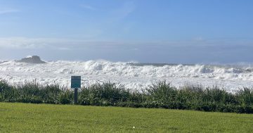
Canberra is a city of false spring, but are the warm temperatures here to stay? Photo: Michelle Kroll.
Canberra just might see its warmest day since April this weekend.
That’s the good news from Christie Johnston, senior meteorologist with the Bureau of Meteorology.
It comes as a high-pressure ridge travels across Australia, bringing clear skies, light winds, and some “single-digit” nights to much of the country’s southeast.
It means that if they can endure a few more chilly nights (with a risk of morning fog and frost), Canberrans can enjoy a few days of mostly sunny conditions over the long weekend.
“We’re seeing temperatures really pick up over a lot of southern Western Australia, and that heat will push into South Australia and inland parts of NSW tomorrow [Saturday, 4 October],” she says.
“We’ll get the peak of it over the ACT and southeast on Sunday.”
And if you’re heading to Sydney for the NRL grand final on Sunday, you’ll be basking in 30-degree weather, according to the BoM, before the mercury drops to the mid-20s as the game approaches in the evening.
According to the BoM, today will top out at 18 degrees (3 October).
Over the long weekend, the ACT can expect temperatures to hover in the mid-20s, even rising to 26 degrees on Sunday, for a taste of summer.
The high-pressure system is also expected to raise the mercury in southeast NSW, meaning the good weather will continue across Capital Country.
Both Yass and Queanbeyan are set to reach 26 on Sunday.
On the coast, the system will bring temperatures as high as 31 degrees in Bega and 30 degrees to Batemans Bay. Moruya, Wollongong and Merimbula will come in just a degree or two shy.
In the Snowies, Ms Johnston warns it could get windy.
“It doesn’t look like we’re expecting wind warnings over the Canberra area on the weekend, but there’s a chance we’ll see some warnings for the Snowies [about] the risk of damaging winds up there.”
She also says the Snowy Mountains could potentially see more snow to round out the season.
In the mountains, their long weekend will dawn with frost and potential fog on Saturday, before warming to the mid- to high-20s over the next few days.
At Jindabyne, temperatures are expected to reach 13 degrees on Friday, before rising to the low 20s and 16 degrees on Monday (6 October).
Cooma will be a little warmer – they’ll start at 17 degrees today, rise to 23 and 27 degrees, before dropping to 21 degrees.
But it won’t last forever, as Ms Johnston says the mercury is set to dip (just a tad) on Tuesday.
“I wouldn’t put away the doona yet!
“The timing could change, but our latest modelling is suggesting that it’s probably likely to come through during the morning, perhaps around mid-morning. … It’ll be cooler in the afternoon as we see some cooler air filtering in.”
Overall, spring is shaping up to be slightly drier, but it will become somewhat wetter as the season progresses.
“It’s a pretty neutral outlook … spring is known as a changeable season, and part of the reason is because we get these frequent cold fronts that come through.
“The northerly or northwesterly winds bring the warm air bring the warm air from inland [Australia], and then the southerly or southeasterly winds bring the cooler air up from the south.”