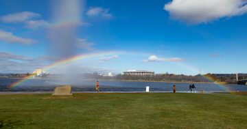
Climatologist Felicity Gamble says the weather will “almost be like a yo-yo” as different systems move through Australia’s southeast. Photo: Michelle Kroll.
If you’ve just pulled out your puffer jacket, it’ll soon be time to put it away again.
The Bureau of Meteorology is forecasting a steady climb from Tuesday’s high of 16 degrees (when we say high, we’re being generous given there was morning frost!)
Senior climatologist Felicity Gamble says a blocking high in the Tasman Sea is growing stronger, which will soon bring warmer conditions to the capital.
She said that, combined with a few inland troughs, it means warm air from inland and northern Australia will be pulled over to the country’s southeast.
“Often you get a spike in temperatures just ahead of that front … If it has quite a significant cool air mass behind it, which we have seen in the last few days, that cold air mass can encroach very quickly.
“You see a sudden shift from the northerly airstream and getting very warm temperatures to suddenly having that very cold air mass that comes in behind the cold front.”
The temperature will remain in the low to mid-20s until Friday, then rise to 28 to 30 degrees over the weekend.
On the coast, Batemans Bay and Moruya will reach the high 20s, while Queanbeyan will hit 30 degrees on Sunday.
But how does it compare to what we’ve seen so far?
Early October brought a warning that the bush capital could see its warmest day since April, while its final days saw the mercury plummet as rain clouds gathered.
Ms Gamble says it was all driven by the “overall state of the climate” – in other words, larger-scale phenomena and patterns that influence our day-to-day weather.
As for what that means for spring, Ms Gamble says it’s too early to tell.
The Southern Annular Mode (SAM), a belt of winds across the Southern Hemisphere, is expected to enter a neutral phase in the coming weeks, which should improve conditions.
“Due to the seasonal weather patterns, they tend to shift a little bit further south, and that’s why Canberra gets those hot, dry summers with fewer fronts coming through and bringing that wet, cold weather.”
Canberra is looking at a warmer-than-average November, with an 80 per cent chance of above-average temperatures in the next fortnight.
Ms Gamble says the rest of spring could still be wetter than average, meaning the capital could see more than its average November rainfall of about 70 millimetres, but it’s impossible to say by how much.
“It’s not a really strong forecast.”
A negative phase of the Indian Ocean Dipole is expected to bring wetter-than-average conditions across parts of Australia for spring and summer before it resolves.
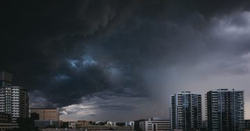
Southeast Australia, including coastal areas of NSW, could see thunderstorms in the coming weeks due to warm waters off the coast (and in the state’s northeast).
“That can provide a little bit more moisture and energy that can enhance the severity of storms.
“We are expecting perhaps a little bit more storm activity this year, just due to that pattern.
“Obviously, Canberra has seen some decent storms over the years!”