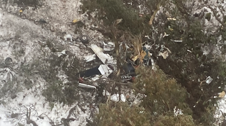
David Stephens’ body and destroyed aircraft were found in the Snowy Mountains after a multi-agency search over several days. Photo: NSW Police/ATSB.
An investigation has concluded that a pilot most likely became disoriented by cloud before his aircraft crashed into the Snowy Mountains earlier this year.
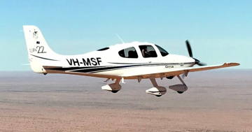
Bega resident David Stephens was killed during a flight from Wangaratta Airport, Victoria, to Moruya Airport on 15 July.
The wreckage of the 74-year-old’s Beechcraft 35-C33 Debonair was found two days later, east of Khancoban, and his body located near the wreckage about a day later.
The Australian Transport Safety Bureau’s final report determined the crash was an accident.
“It is very likely that the pilot, who did not hold an aircraft instrument rating, experienced spatial disorientation after flying into instrument meteorological conditions (IMC),” it stated.
“Soon after entering the Snowy Mountains area, the aircraft made a 150-degree right turn, shortly followed by another long left turn.
“The aircraft entered a spiralling descent to the right that continued until the aircraft collided with terrain.”
The ATSB found it was “likely not feasible” for visual flight rules to be maintained during the flight, based on the forecast cloud between Wangaratta and Moruya.
Mr Stephens held a recreational licence and had completed some training to attain navigation endorsement, but didn’t have full accreditation.
“It is possible that the pilot’s limited training and experience in this respect affected their decision to conduct or continue the flight into challenging weather conditions,” the report noted.
The vertical extent of the cloud would have presented a particular challenge to Mr Stephens, as it probably wasn’t possible for him to fly above the broken cloud and stay under 10,000 feet (in line with his licence restrictions). He also wasn’t authorised to fly the distance between Wangaratta and Moruya as he hadn’t completed the relevant training.
He had taken his plane from Frog’s Hollow to Wangaratta for routine maintenance, and was on his way home when the accident occurred.
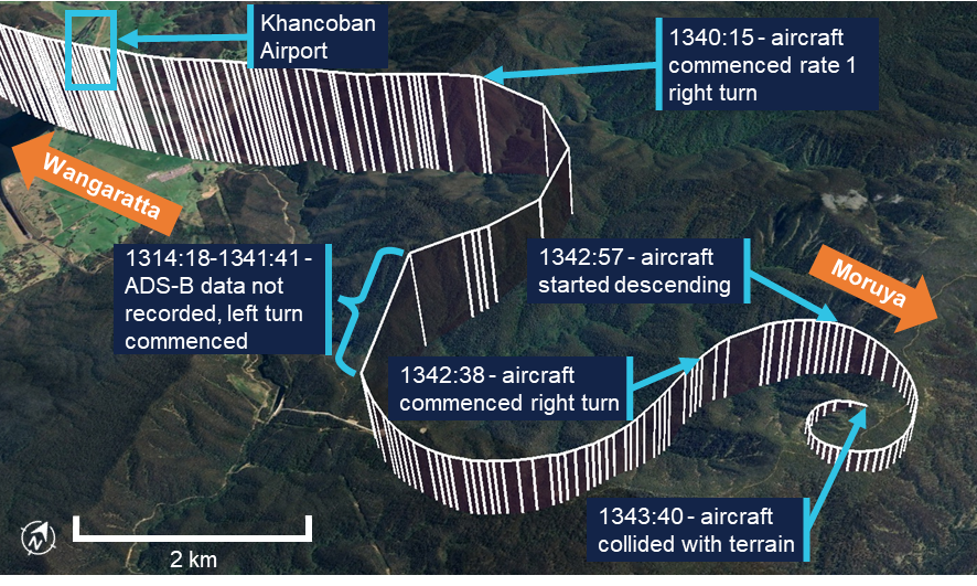
Vertical lines show the aircraft’s height above terrain. Each line represents a data point. Source: Google Earth, annotated by the ATSB.
The ATSB report made reference to a Civil Aviation Safety Authority publication that detailed how pilots can enter what’s known as the “graveyard spiral” when they become spatially disoriented.
“For non-instrument rated pilots, entering IMC can quickly become fatal. Research has shown that pilots not proficient in instrument-only flight will typically become spatially disoriented and lose control of the aircraft within 1–3 minutes after visual cues are lost,” it stated.
“The aircraft’s steadily increasing rate of descent and rate of turn in the period leading up to the impact with terrain were consistent with spatial disorientation, specifically, the somatogyral illusion and the ‘graveyard spiral’.
“Given the terrain elevation in the area, it is therefore almost certain that the aircraft encountered weather conditions making visibility marginal or worse, possibly for extended periods.
“The aircraft’s increasing rate of descent and maximum allowable airspeed exceedance just before the collision with terrain indicated that the pilot was either not aware of the aircraft’s speed and attitude, or was not able to correct it during the descent.”
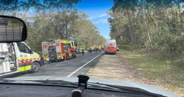
Mr Stephens’ aircraft was not fitted with an emergency locator transmitter; however, he had lodged a search-and-rescue time (SARTIME) with Airservices Australia.
The Joint Rescue Coordination Centre (JRCC) was notified when this time elapsed, and a multi-agency search began.
“Visibility was affected by cloud, and in the early stages of the search, helicopters had limited access to the area where the aircraft was last detected,” the report stated.
“After an extended search by air, the aircraft was located on 17 July in steep, forested terrain with snow cover.”
The ATSB gave several safety messages as part of the report (as is the purpose of many investigations), warning pilots should not only obtain up-to-date weather information before and during a flight, but they should plan an alternative landing point and be prepared to make necessary changes from the planned route should the weather conditions make it necessary.
It also emphasised the importance of licence restrictions and endorsements.
“They ensure that pilots have been trained to an acceptable standard and that the appropriate experience has been attained,” the report said.
“Studies show that pilots with less weather experience are more likely to engage in high-risk activities when dealing with weather.
“This accident is an important reminder to respect these restrictions and endorsements when planning a flight.”
Original Article published by Claire Fenwicke on About Regional.