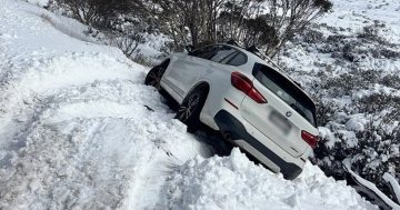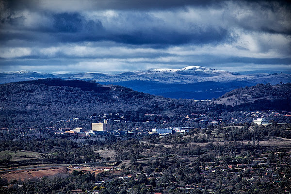
This in from Ben Dover, can anyone help him find the snow?
I took this this morning, looking from Stromlo, across Woden. Does anyone know which hill the snow in the distance is on?
Cheers M’dears.
B-D
This in from Ben Dover, can anyone help him find the snow?
I took this this morning, looking from Stromlo, across Woden. Does anyone know which hill the snow in the distance is on?
Cheers M’dears.
B-D
Canberra’s leading relationship lawyers, specialising in family law, including divorce, as well as wills and estate planning.
 Huglo Solar
Your energy mate, providing straight forward solar and battery advice that saves you money, and reduces the impact on the environment.
 Asset Construction Hire
Locally run construction hire company, providing clients with superior equipment.
Established in 1968, we are professional solicitors focusing on conveyancing.
We offer everything you need to celebrate and farewell your loved one.
 Clarity Home Loans
A passionate team of Canberrans helping other Canberrans secure their home loans. No frills, no commissions, no brainer.
Canberra’s leading renovator, specialising in residential renovation services.
We're proud to give you a place where friends and family can come together for good food and great entertainment.
Want the best Canberra news delivered daily? Every day we package the most popular Region Canberra stories and send them straight to your inbox. Sign-up now for trusted local news that will never be behind a paywall.