21 October 2025

Batten down the hatches - wild wind and storms are on their way

| By Claire Sams
Join the conversation
53

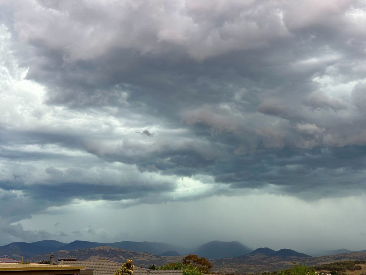
Storm clouds rolling in over the Brindabellas near Tuggeranong earlier this year – expect more shortly. Photo: James Coleman.

Wild winds and storms are just some of the extreme weather being forecast for the next few days for southeast Australia.

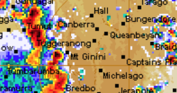
It’s all part of a cold front sweeping across much of eastern Australia, pulling hot air from the Northern Territory and central Australia to the country’s east.

Bureau of Meteorology senior meteorologist Miriam Bradbury said the system will arrive in southeast NSW and the ACT late on Tuesday and last into Wednesday.

“We’re going to see a risk of severe thunderstorms … The main risk time for that is going to be from early afternoon [today].”

“Generally, those storms should be non-severe, but there definitely is a risk that they could become severe and they could bring some damaging winds.”

The mercury will also spike beyond normal spring temperatures, with Canberra to reach 30 degrees today and tomorrow.

In regional NSW, Batemans Bay will reach 34 degrees tomorrow, while Wollongong will swelter through 36.

Other locations – such as Yass, Merimbula, Wagga Wagga and Bega – will hover around 30 degrees.

READ ALSO UNSW Canberra’s city campus project is underway. Here’s what it will offer

Ms Bradbury describes the conditions as a “perfect storm” that is bringing a taste of summer to the southeast

She also urged people to follow any directions from emergency services about fire safety, saying that the warmer and windy weather could combine to ignite fires.

“There was already a lot of heat sitting across the northern parts of Australia. As this cold front approaches, it has the opportunity to tap into that.

“It’s that combination of the heat and the strong winds that is driving the fire dangers, thunderstorms and the strong winds.”

She also said meteorologists were watching for the “big fire starter” of dry lightning, which is an extra risk as only a few patchy showers are forecast (rather than a drenching).

“It’s possible anytime we’ve got thunderstorms forecast, but not a whole lot of rain forecast … It’s not our number one concern tomorrow, but it’s definitely something to be mindful of, as well.”

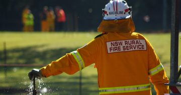
ACT Rural Fire Service operations manager Ken Hall said the Territory would likely see a ‘Moderate’ fire rating in place for the rest of the week.

As summer approaches, Canberra firefighters are preparing for the bush capital to continue drying out, with southern parts of the ACT already starting that process.

“What we’re seeing this year is that the drying pattern that started to come in last year is continuing this year,” he said.

“Those conditions we saw yesterday [20 October], and the winds and lack of rain at the moment, we will see our grasslands and forest areas dry out over the next few weeks.”

READ ALSO Second dog dies after walk at Lake Ginninderra – could the government be doing more to protect our pets?

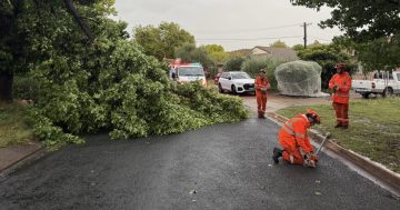
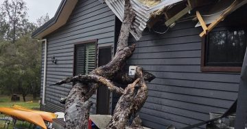
On Wednesday, Illawarra, Far South Coast, Snowy Mountains and parts of the ACT above 1500 metres could see damaging winds from 55 km/hr to 75 km/hr (with gusts up to 100 km/hr possible), according to the BoM’s latest warning.

Ms Bradbury urged people to be careful when out and about over the next 48 hours, warning that the strong winds can take down trees and power lines, or push debris onto roads.

“Staying cool, staying indoors, staying hydrated is the best advice,” she said.

“I guess the good news is that it’s really a one-day event at this stage. Once we get to Thursday, everything eases right back off.”

The NSW State Emergency Service also advises that during storms, people should:

  • Move your car under cover
  • Keep clear of creeks and storm drains
  • Don’t walk, ride your bike or drive through floodwater
  • If you are trapped by flash flooding, seek refuge in the highest available place and ring 000 if you need rescue
  • Be aware that run-off from rainfall in fire-affected areas may behave differently and be more rapid. It may also contain debris such as ash, soil, trees and rocks
  • After bushfires, heavy rain and the loss of foliage can make the ground soft and heavy, leading to a greater chance of landslides
  • Unplug computers and appliances
  • Avoid using the phone during the storm
  • Stay indoors away from windows, and keep children and pets indoors as well
  • Stay vigilant and monitor conditions. Note that the landscape may have changed following bushfires.

The latest forecasts and warnings are available through the BoM’s website or the BOM Weather app.

For emergency help in floods and storms, call the SES (NSW and ACT) on 132 500. The ACT ESA also maintains an incidents page where locals can view ongoing hazards, incidents and response efforts.

Free Daily Digest

Want the best Canberra news delivered daily? We package the most-read Canberra stories and send them to your inbox. Sign-up now for trusted local news that will never be behind a paywall.
Loading
By submitting your email address you are agreeing to Region Group's terms and conditions and privacy policy.

Join the conversation

53
All Comments
  • All Comments
  • Website Comments
LatestOldest

The good news today is that the wild wind and storms have disappeared.

And Canberra hasn’t got anywhere near 30 degrees. Top temperature 20.5.

😂😂😂

Oh dear, once again he goes near numbers and once again completely stuffs it up.

“Btw reading a temperature gauge doesn’t require mathematics.”

You would think without mathematics, Pengold would be safe, but alas even reading numbers has proven too much.

Climate was always beyond him but now even simple weather has proven too hot to handle.

Capital Retro7:38 am 24 Oct 25

How dare you introduce facts to challenge the doom narrative, Penfold.

“How dare you introduce facts to challenge the doom narrative, Penfold.”

😂 still having trouble with that new website I see, this response couldn’t be more perfect.

“Facts” 😂😂

Sometimes these facts can be an inconvenient truth CR.

Though there is a presumption that the numbers haven’t been “homogenised”, in which case these facts might become yesterday’s facts. So hard to tell these days.

Penfold and “facts”…good one Capital. lol

😂😂😂

Sometimes reality can be even more inconvenient.

Particularly for those who can’t even read the right numbers off a website.

😂👨‍🦯

Capital Retro4:42 pm 22 Oct 25

My point is the BOM stopped data going into the format it has used for years at 10.30am today and switched to a new format which is very difficult to use.

You need to get an old thing called a map Axon.

The format they have been trialling for a year, as chewy14 mentioned. You could have tried it earlier. You could deal with change when it happens.

It isn’t especially user friendly, though i like the Feels Like feature. The Radar function is a big step backwards. The Indigenous Weather Knowledge function is rather strange.

But they now have a “Weather and Climate” function, which suggests they’re the same thing. That might upset a few people.

Though the highlight was the climate change section which advises us that we’ll get more heavy rain and more drought. Go figure. A bob each way perhaps ?

https://www.bom.gov.au/resources/learn-and-explore/climate-knowledge-centre/climate-change-in-australia

“Though the highlight was the climate change section which advises us that we’ll get more heavy rain and more drought. Go figure.”

Penzero not understanding basic concepts again, must be a day ending in y.

So conditions similar to 2020. Will Albo hold a hose?

The problem with Morrison’s statement was his trivialisation of threat to life, damage and loss. Yours is to carry on in the same vein.

Pretty obvious answer to that FP. Wouldn’t know the tap end from the nozzle.

But you can bet Tony Abbott will be.

Abbott holds only a firehose of misinformation.

Capital Retro1:24 pm 22 Oct 25

It’s supposed to be 39 in Newcastle today.

It’s currently (1.23pm) 21.3.

At 3 PM it was 35.4, having peaked at 36.6 at 2.33 PM. In fact it was well over 21 by 1 PM during its near-vertical climb. That was at Newcastle Nobbys. You might prefer Williamstown where it peaked at 39.8 or Lake Macquarie 38.1 or Tocal 38.9.

In any case, what is your point?

You really are having trouble with that new fangled BOM website aren’t you.

Capital Retro4:38 pm 22 Oct 25

My point is the BOM stopped data going into the format it has used for years at 10.30am today and switched to a new format which is very difficult to use.

You need to get an old thing called a map Axon.

It was supposed to be 31 in Canberra today. Now it feels like 9, the ugg boots and track dacks are out.

Capital Retro12:38 pm 22 Oct 25

The BOM have today changed all their website information regarding weather maps etc which is making it more difficult to do self-assessments of the weather.

Why?

Probably homogenised their weather observations again. 🌩🔥

Capital Retro1:20 pm 22 Oct 25

Their equivalent of a “smart meter”?

Capital Retro1:41 pm 22 Oct 25

“BOM Weather is free and ad free on mobile and tablet devices.”

So, some of us who have desktops are excluded?

Again, why?

They’ve only been talking about it for ages, with the beta version of the new site being operational for over a year.

https://www.bom.gov.au/news-and-media/new-website-launches-22-october-2025

Carry on.

Capital Retro wrote: ““BOM Weather is free and ad free on mobile and tablet devices.” So, some of us who have desktops are excluded?”

You just looked at their site in your browser and it cost you nothing.

Tell me more about your home planet.

Capital Retro4:40 pm 22 Oct 25

They haven’t been talking to me chewy.

46 deg predicted in Birdsville (another record). Maybe when temperatures hit 50 deg or 55 deg the skeptics will start believing science & the experts instead of following the MAGA script.

franky you’re starting to sound like the UN global boiling bloke who struggles with science.

Fyi the highest temperature ever recorded in Australia is 50.7 °C (123.3 °F), which was recorded on 2 January 1960 at Oodnadatta, South Australia and 13 January 2022 at Onslow, Western Australia.

At least that’s what the experts tell us. It’s unclear whether these were “homogenised” observations or not.

Only three of the highest temperatures have been recorded in the 21st century. 46 At Birdsville is not a record. That was set in 1972 with a temp of 49.5. The science doesn’t seem to suit your narrative. Keep trying though. Chicken Little needs a new scare
https://www.bom.gov.au/climate/extreme/records.shtml

Futureproof,
The “record” is that Birdsville just recorded its hottest October day.

Keep trying though.

chewy14, Birdsville hottest day – so what. Life goes on. It may get hotter. Birdsville is not exactly on the coast with sea breezes. Perhaps place a stonking wind turbine above the pub. That should cool the place down

Well I did tell you to keep trying, however ineffectually.

Only took you one comment from going herp derp “the science doesn’t suit your narrative” to ” hottest day, so what”, LOL.

I see the regular clowns are out in force again.

A cold day in winter apparently means climate change isnt real but a series of 30+ days in October is normal weather variation, nothing to see here.

No one was expecting any different from them.

🤡🤡🤡👨‍🦯👨‍🦯👨‍🦯

Huh? A cold day in winter is expected but +30C in Springitme (October) isn’t.

Yes typically Seano.

The average max. for Sept/Oct in Canberra is below 20 so unless maths works differently in your world Karl…no, not typically.

An average is the aggregate of a group of observations divided by the count of observations. By definition there will be higher and lower observations.

Btw reading a temperature gauge doesn’t require mathematics. Adding numbers together does.

“An average is the aggregate of a group of observations divided by the count of observations. By definition there will be higher and lower observations.”

You do have to laugh when he tries to sound supercilious but makes basic logic and mathematical errors in his comments.

😂😂😂

LMAO….another classic attempted “gotcha” ends in another classic Penfolidian self-own.

I’ll explain it for you, now bear with me here because clearly maths is another topic you’re happy to smugly opine on without actually understanding it…if temperatures where “typically” above 30….then the average would not be below 20. But temperatures in Sept/Oct above 30 are “not typically” the norm.

I do love how you finish beclowning yourself with a smug but completely oblivious slight as if you haven’t beclowned yourself again…it’s a nice comical flourish. lol

Genius stuff as always Penfold.

You’ll be delighted to know i’m laughing with you seano.

“if temperatures where “typically” above 30….then the average would not be below 20. But temperatures in Sept/Oct above 30 are “not typically” the norm.” (sic)

Was that logic taught to you somewhere or is it seanomatics ?

Perhaps you’re confusing the rainfall statistics (mm) with temperature (oC) in the link you posted. The new BOM website does have some confusing features, we can agree on that.

Another Penfold bad faith gotcha attempt ends in another tedious Penfold attempt to dig himself out of another hole.

The puerile pretence you don’t understand the point that if temperatures were “typically” above 30 (typically meaning most of the time) then the average would not be below 20….well not without some wild temperature extremes (which don’t happen) is laughable.

Your “gotcha” fails, on logic (see above) and fact (see the link to the bom).

Temperatures in the ACT during Sept/Oct are “not typically” above 30.

You can keep beclowning yourself if you like, IDC I think it’s funny.

It’s hard to understand what you’re getting at seano. There’s nowhere in Australia, nor the planet, where temperatures are typically above 30. Whoops sorry, the furnace a nice coal or nuclear plant would be an exception to that.

Just to help out with your maths struggles, it’s perfectly feasible to have “typical” readings of any data set to be 30 and an average below 20. Though of course this would mean a high standard deviation amongst observations. But apologies, that’s likely a bridge too far.

I’m already dressing like it’s Summertime.

Heywood Smith1:52 pm 22 Oct 25

@karl – budgie smugglers?

Weren’t we supposed to “boil?”

Heywood Smith1:15 pm 21 Oct 25

@Rob.. Someone once said something about this climate change thingamajig happening.

The new term Rob is “extreme weather”. Global warming and drought couldn’t be applied to freezing winters and Warragamba overflowing. 🌩🌪☔️☄️⛄️

and neither of you noticed the references to heat. What sort of folly does it take to imagine that rain means no climate change?

Rob might have been referring to the 🤡 from the UN running around yelling “global boiling”.

Science tells us the boiling point of water is 💯 o C 🤣

Yeah but not during Springtime!

Daily Digest

Want the best Canberra news delivered daily? Every day we package the most popular Region Canberra stories and send them straight to your inbox. Sign-up now for trusted local news that will never be behind a paywall.

By submitting your email address you are agreeing to Region Group's terms and conditions and privacy policy.