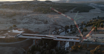
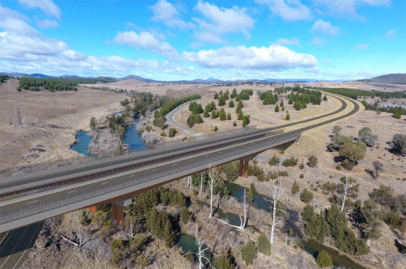
It’s a big crane for a big job. It will lift 160-tonne steel girders into place across the Molonglo River. Photo: Ryan Hemsley.
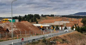
The big crane is up at the Molonglo River Bridge site at Coppins Crossing, ready to lift 20 steel girders transported from Newcastle into place from 28 April.
The job will take up to three weeks and Coppins Crossing Road will close from 5 am on 28 April, reopening on or before 17 May 2025.
The girders weigh 160 tonnes, are 70-metres long and 5.36-metres high.
Coppins Crossing Road will close between Holborow Avenue and Hazel Hawke Avenue today (17 April) from 10 am to 3 pm to enable the safe transfer of the girder transport system across the river.
During the long closure, the northern side girders will be lifted into place. The southern side steel girders can be lifted safely without closing Coppins Crossing Road.
The lift requires the second-biggest crane in Australia, taller than Black Mountain Tower, according to City and Government Services Minister Tara Cheyne.
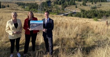
Ms Cheyne said the girder job would be a significant milestone for the Molonglo River Bridge, but a project of this size requires the area to be closed for a period of time.
“This has been years in the making and months and months of planning,” she said.
“It’s unavoidable and it’s inevitable that we have to make this closure. We’ve tried to give as much time as possible so that people can prepare.”
Ms Cheyne said the sheer scale and logistics of the operation meant that it could not be aligned with school holidays to minimise disruption.
A viewing platform has been provided to safely watch the crane in action. To access the platform, park at the Namarag Reserve car park off Thancoupie Crescent and follow signs to a designated viewing area. To stay safe, do not go beyond barriers, slow down or stop on Coppins Crossing Road.
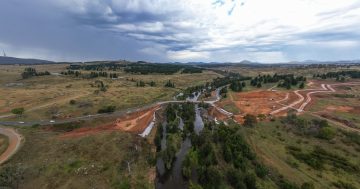
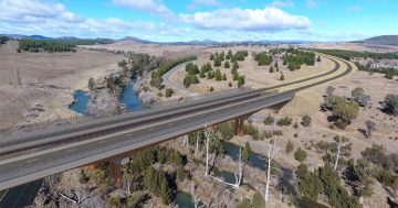
Smoother, faster, safer: What the complete Molonglo River Bridge will look like. Photo: ACT Government.
Infrastructure Canberra said the closure would ensure the safety of road users, the public, and other personnel on and around the project site.
Motorists are asked to use these detours:
- Southbound from Belconnen – from William Hovell Drive, take the off-ramp to Parkes Way and merge onto Tuggeranong Parkway.
- Northbound from Molonglo Valley – from John Gorton Drive turn onto Cotter Road then follow the ramp onto Tuggeranong Parkway and take the left exit at Glenloch interchange to merge onto William Hovell Drive.
Commuters are also urged to rethink their routine and consider travelling earlier or later to avoid peak times and allow for additional travel time.
Public transport will also be affected.
Bus Route 47 will not service Denman Prospect during the closure and will only service stops between Belconnen and Whitlam.
Dedicated school services will continue to operate as normal from Denman Prospect. However, students who usually connect with Route 47 in Denman Prospect will need to arrange alternative travel options to access their school services.
Students attending Evelyn Scott School via the Route 47 temporary school-only service may arrive after the morning school bell. The afternoon school-only service is also expected to experience some delays for the return journey after departing from Evelyn Scott School.
The new bridge will span 200 metres across the Molonglo Nature Reserve and river, and combined with 1.7 km of new arterial roads and two new intersections, it will provide smooth, safe and faster access to the future Molonglo Town Centre from the suburb of Whitlam and future northern Molonglo Valley suburbs.
It will also deliver a long-awaited dependable link between Belconnen and Canberra’s south.
The works include off-road shared paths and a pedestrian underpass to encourage more Canberrans to ride or walk.
To stay up to date on the impacts, visit the Built for CBR website.